
Walk a Metairie Street by Address
A reliable Metairie street directory search separates ownership from occupancy. Jefferson Parish publishes the owner of record and parcel details, while a directory or voter-portal match may place a person at an address at a certain time. Neither proves that every household member was listed. Work from the exact site outward, and save the date and wording shown by each source.
- Normalize the address with USPS, then search the Jefferson Parish Assessor by property address. Record the physical address, parcel number, subdivision, block, lot, ward, and owner.
- Open JeffMAP and locate the same parcel. Check the building, parcel lines, zoning, streets, and any road or canal that changes what counts as adjacent.
- Use the Louisiana Voter Portal address mode only as a separate resident clue. Its privacy notice says voter and address records are not linked to each other.
- Copy the deed number, date, amount, and book from the parcel card. Follow that reference into the Clerk’s mortgage and conveyance index.
- For a past household, consult a dated criss-cross directory at the regional archive or library. Confirm the entry with a deed, newspaper, census, or other dated source.
This order also prevents a common error: treating the assessor’s mailing contact as the person who occupies the Metairie property. A result becomes stronger only when two independent, dated sources agree.
Search Metairie Assessor Street Fields
The Jefferson Parish Assessor Parcel Search offers four routes. Property Address is the direct street mode, but subdivision, block, and lot can recover a parcel when an address has changed. Owner and parcel-number modes help confirm the result. No ZIP, value-range, ward, or sale-date filter appeared on the search screen.
| Search choice | Input shown | Best street use |
|---|---|---|
| Property Address | Street address | Open a known Metairie site |
| Owner | Last,First with no space | Find other parcels under a recorded name |
| Parcel # | Parcel number | Return to the exact assessment record |
| Subdivision | Subdivision, block, lot | Bridge a changed or uncertain address |
The parcel card then shows the physical and mailing addresses, legal description, values, deed rows, owner history, and location fields. The 2026 display was preliminary when researched, so verify current values before relying on them.
The official parcel-detail example shows how those sections appear on screen.
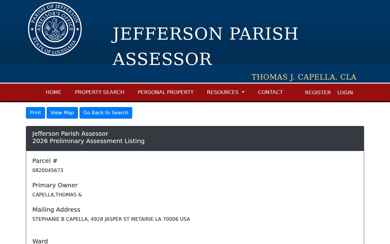
The screen structure makes the physical-versus-mailing split visible and gives the deed references needed for the next step.
Decode Metairie Street Record Terms
Street records use a few terms in precise ways. Reading them correctly keeps a map clue from becoming an unsupported claim about a household.
- Parcel
- A mapped unit used for assessment. It may be split, merged, or represented as a condominium unit.
- Situs address
- The physical location of the property, distinct from the owner’s mailing contact.
- Plat
- A recorded map that identifies subdivision land, lots, blocks, streets, and other boundaries.
- Criss-cross directory
- A directory arranged by street and house number instead of only by surname.
When a number or street spelling shifts, the legal description and parcel history are usually safer anchors than the modern address alone.
Browse Metairie Streets in JeffMAP
The JeffMAP Planning and Zoning Map searches an address, nearest intersection, or subdivision. Select a building for its address and planning context, or click the parcel for lot, subdivision, and zoning information. Layers cover buildings, streets, parcels, imagery, land use, political boundaries, and zoning. The map excludes incorporated parish municipalities, which matters because Metairie itself is unincorporated.
For a whole street segment, zoom until parcel lines and buildings are clear, then open each parcel. JeffMAP did not expose a one-click list of all owners on a named street. Its buffer tool can instead use a selected property lot or a drawn polygon, a distance and unit, and an Excel export. Review roads, canals, and corner lots before calling parcels adjacent. The viewer is not a survey.
Note: Record the map date, chosen layers, buffer shape, distance, and selected parcel so another researcher can repeat the Metairie street search.
Metairie Street Directory Record Channels
No single Metairie street directory is a master household roll. The sources below connect an address to a public record for a stated purpose. Online access is only the first channel. Clerk and Assessor counters, library reference help, archive appointments, phone calls, forms, and bounded public-record requests fill the gaps.
| Record Set | Keeper | What It Shows | Access |
|---|---|---|---|
| Assessment and tax | Parish Assessor and Sheriff | Owner, parcel, situs, tax-year bill status | Portal, phone, counter, written roll request |
| GIS parcel map | Jefferson Parish Planning | Parcels, buildings, subdivision, zoning, buffer | JeffMAP, Planning counter, metadata request |
| Recorded deeds | Clerk Mortgage & Conveyance | Transfer parties, date, book, legal description | JeffNet, Clerk counter, copy request |
| Voter search | Secretary of State and Registrar | Restricted address-search route | State portal, Registrar office, lawful list request |
| Permits and code | Parish departments | Work, complaint, inspection, or status context | MGO, tracker, department, NextRequest |
The parcel number is the strongest bridge among the map, assessment, tax, and deed systems. Preserve the street form too, since the voter portal and historic directories are keyed to address text rather than a parcel identifier.
Follow Metairie Streets into JeffNet
The Assessor’s deed row is a lead, not the full instrument. Take its deed number, date, amount, and book to the Jefferson Parish Clerk JeffNet route. The typed mortgage and conveyance index begins in 1967. Pre-1967 index images span 1825 through 1966, and the Clerk describes document images from 1825 onward.
This cutoff is a change in search method, not the end of Metairie property history. A later deed can identify the prior owner, legal description, book, and lot needed to enter the older image index. At the Clerk counter, ask about public inspection or a copy by instrument reference. Written requests and copy or certification routes remain available when the portal account does not supply what is needed.
A deed type matters. Sale, donation, succession, correction, judgment, mortgage, and release do not mean the same thing. Keep “recorded owner” separate from “directory resident.”
Check Metairie Tax Address Results
The Jefferson Parish Sheriff property-tax portal searches Property Address, Tax Notice Number, or Parcel Number. Its results include municipal address, owner of record, ward and parcel number, tax year, notice number, assessment, original amount due, paid amount, and balance. The portal warns that the screen assists payment and is not a tax certificate.
The official tax-search image shows the address-keyed entry point used in the street directory chain.
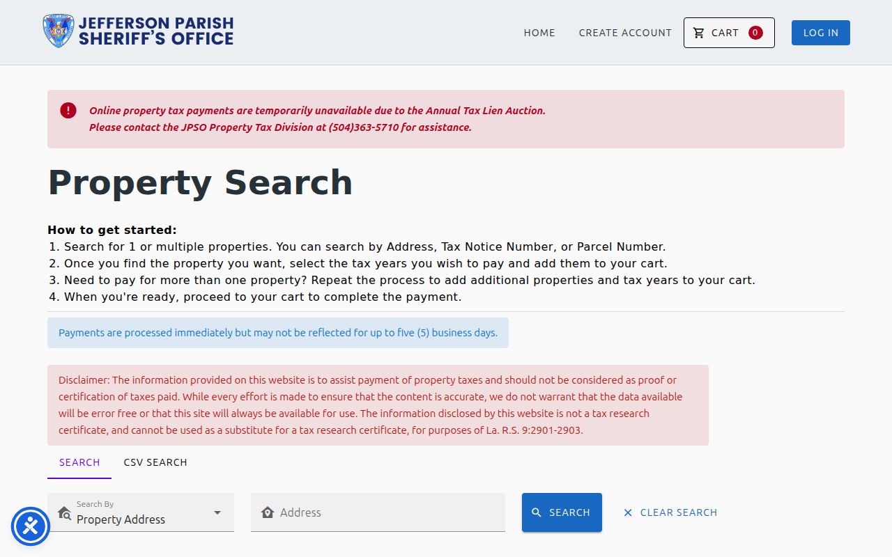
Use the tax year and parcel number to reconcile the bill with the same dated Assessor record. Tax status and a homestead indicator still do not list every occupant.
Metairie Street Permits and Code Files
Parish permit, planning, and complaint records add event dates to an address. MGO Connect routes building and planning applications, but its public result fields and historical cutoff were not stable during research. A project number, exact address, department phone call, or focused NextRequest filing is the fallback.
The parish code-violation page leads to the service tracker.
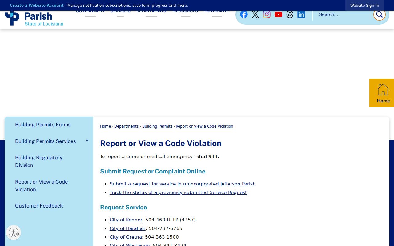
A complaint can show a reported issue and status, not who occupied the property or who filed it. Ask for a complaint number or bounded date range rather than a broad resident list.
Old Metairie Street Notice Trails
The Old Metairie Commission creates an unusually specific land-use trail for certain new houses, demolitions, pools, and conservation-district matters. Its process includes a posted sign, legal advertisement, hearing, and letters to owners within 300 feet. Agendas, minutes, staff reports, JeffMAP, and the subject parcel should be read together.
The official commission page provides the public route into those records.
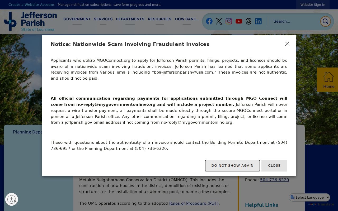
The notice circle documents a bounded group of owners around a public matter. It does not prove that each notice recipient lived on the block.
Search Past Metairie Streets Carefully
A historical street directory entry places a listed person at a written address in one publication year. R.L. Polk’s separate New Orleans Suburban directory began in 1955, and Haines & Company’s CrissCross series began in 1966. The New Orleans City Archives directory collection holds suburban runs, with address copy requests permitted after 1938.
Search title, year, area label, street spelling, and house number. Metairie can appear within New Orleans or New Orleans Suburban reel descriptions. Missing years include publication, reel, and catalog gaps, so a failed search is not proof that nobody lived there. Full collection coverage belongs in the Metairie city directories account.
Limits of Metairie Street Records
A Metairie street directory cannot provide a complete, current list of everyone in a home. Parcel records focus on ownership and assessment. A directory is dated and selective. The voter portal withholds protected fields and warns that voter and address records are not linked. No public utility-customer or hookup roster was located, and a service request can document an event without identifying the household.
Use labels such as recorded owner, mailing contact, directory entry, voter-portal match, and adjacent parcel. Add a source date. Those words preserve the legal relationship shown instead of turning a narrow record into a claim about private life.
Lawful use. Metairie address records are for lawful personal research, family and property history, and civic review. Never use an address trail to stalk, harass, threaten, or harm anyone.
For one named person rather than a whole street, use the Metairie resident lookup workflow and confirm each result independently.